A windrose is a tool meteorologists use to summarize the view of how fast the wind is moving and in what direction in a particular area. This picture is just an example of what windrose looks like.
LIDAR stands for Light Detection And Ranging. Its done by using a laser beam scanned from side to side by an aircraft that flies over an area to make an accurate model of the ground and its features. It measures between 20,000 to 150,000 points per second.
Infrared maps are used so that people can see the other features to the planets surface that can not be seem in regular light. this is an Infrared Aerial Photo of the Discovery Bay in The Delta National Park. It shows that there a cul-de-sac community of boat owners.
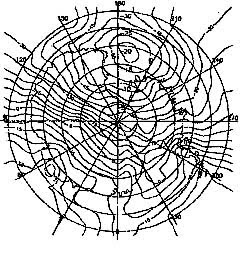
A isoline map is a map with continuous lines joining points of the same value. they are used to interpret information on thematic maps sometimes. This map is showing the weather on Antarctica.
A Flow map is a combination of a flow chart and a map. It shows the movement of something from one place to another. This is a map of the telecommunication traffic in between countries in the European region of the world. The thicker the lines are the more call volume is experienced between countries.